A team from the University of Texas is conducting a groundbreaking study on Greenland’s glaciers to understand the underwater mechanisms of glacier melting and the role of sediments in slowing this process. Their findings will provide insights into future sea level rises, essential for preparing coastal communities globally.
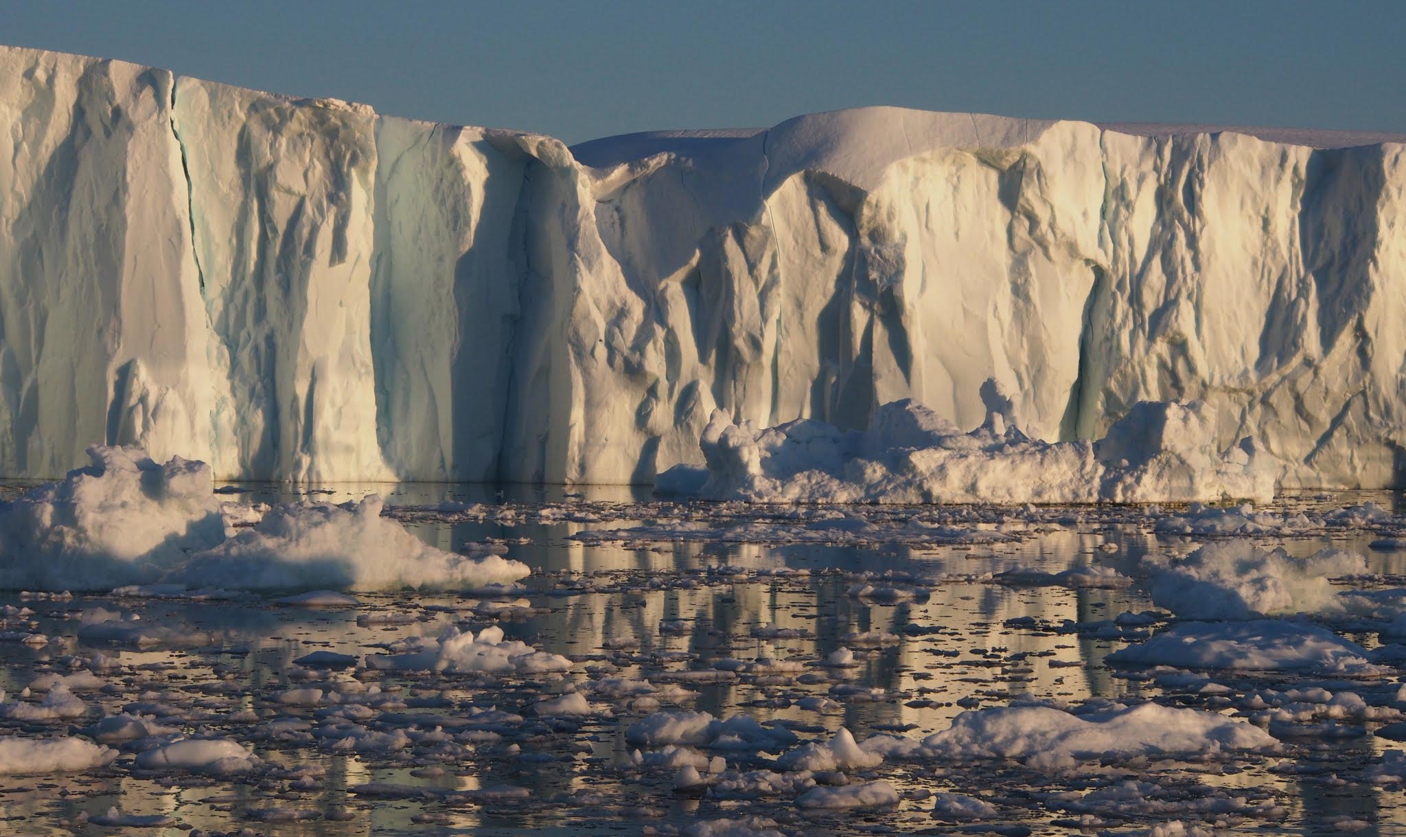
A team of scientists from the University of Texas at Austin have embarked on a four-week expedition to explore the underwater edges of Greenland’s coastal glaciers to learn more about future sea level rise. In collaboration with international partners, the scientists will investigate processes that control how these giant glaciers melt and what that means for the future of the Greenland ice sheet, which has about 23 feet (7 meters) of potential sea level rise locked away in its ice.
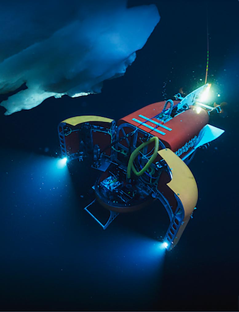
Joining the researchers is a robotic submersible that will gather measurements of the glaciers’ underwater walls and sediment-laden meltwater, a feat that’s never been attempted up close. The scientists will also conduct extensive surveys of the seafloor and gather sediment cores that will let them wind back the clock to see how past periods of climate change affected glaciers.
Understanding Sediments and Glacial Stability
A key research question is the role of sediments in slowing glacial melt, said the expedition’s chief scientist Ginny Catania, a research professor at the University of Texas Institute for Geophysics (UTIG) and UT’s Department of Earth and Planetary Sciences. UTIG is leading the expedition and is part of the UT Jackson School of Geosciences.
“Most of the ice sheet has retreated, but there are a few glaciers that have not retreated next to glaciers that have retreated a lot. And it could be because sediments are stabilizing the glaciers,” Catania said.
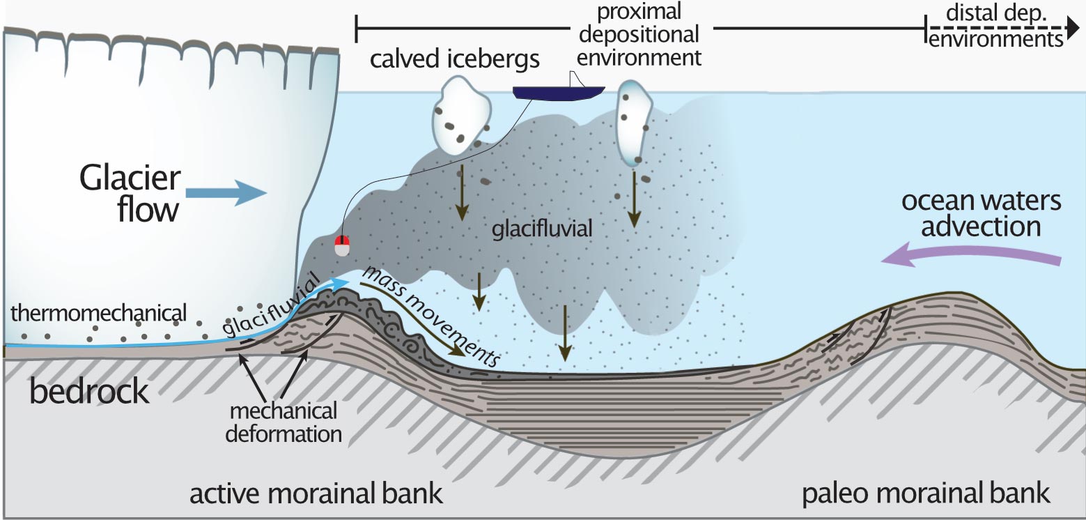
The researchers think that the glaciers are protected from warm ocean currents by underwater walls, called moraines, that pile up from sediment carried from beneath the glacier itself. These buttressing walls also form when glaciers advance, bulldozing the seafloor ahead of them.
But how effective are they at slowing melt, how quickly do they form, and how long do they persist? Answering those questions should give scientists a much better idea of the future of the ice sheet both in Greenland and Antarctica, where sediment may also play a role in stabilizing glaciers. These answers, in turn, can help with predicting how quickly the sea level will rise in the coming years.
Advanced Technologies and Data Collection
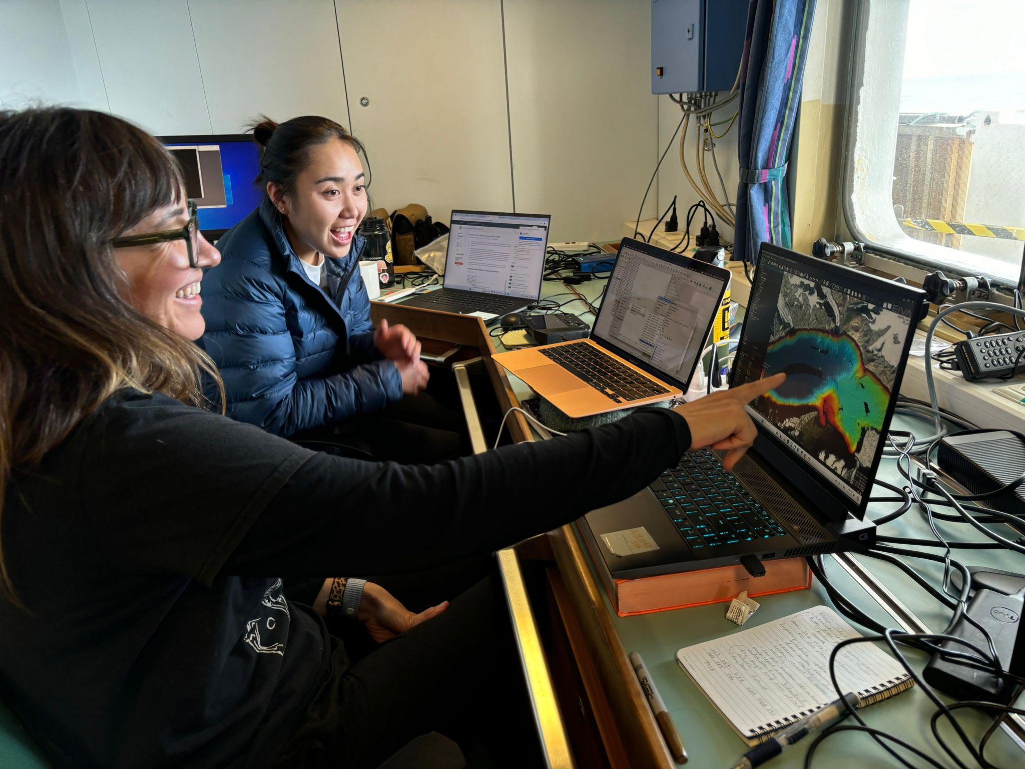
Catania explained: “This is a big mission to try to capture as much information about how the glaciers behave underwater with these really sophisticated tools that we haven’t been able to use in the past.”
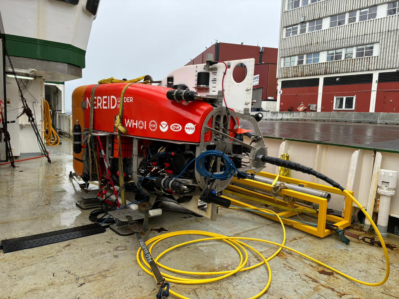
The robotic submersible Nereid Under Ice (NUI) is key to collecting the data that can answer these questions. NUI was developed and is operated by engineers at the Woods Hole Oceanographic Institution, who are on board for the mission. It is specially designed to navigate the treacherous, icy environment of the glacial fjord, where it will use its sensors and samplers to measure sediments flowing out from under the ice and to conduct unprecedented, up-close geophysical surveys of the ice and seafloor.
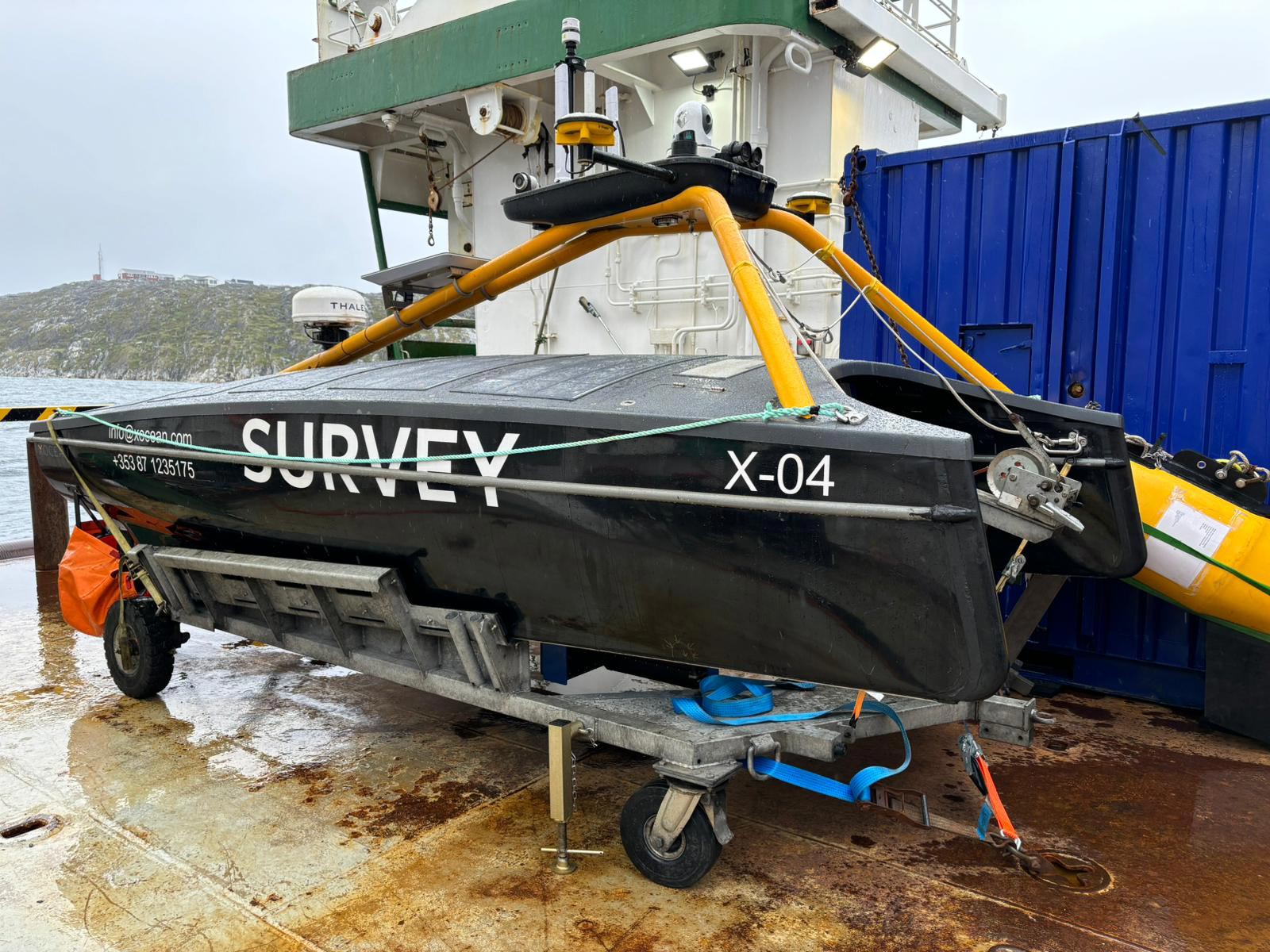
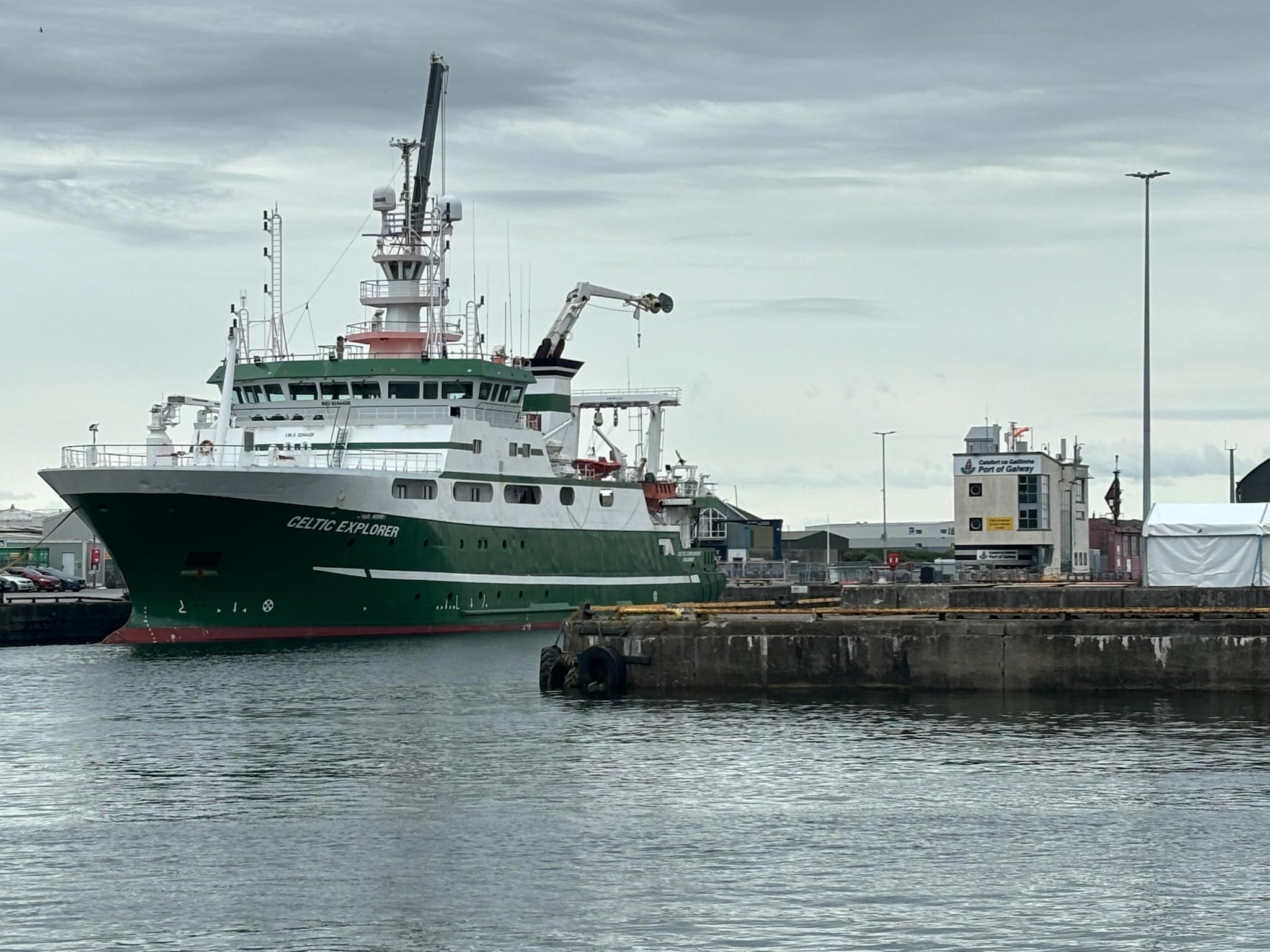
Similar measurements will be made by an XOcean sea surface drone and larger instruments aboard the expedition’s vessel, the Marine Institute of Ireland’s RV Celtic Explorer. Researchers will also gather data from the glaciers’ surface using aerial drones.
Implications for Coastal Communities
What the expedition reveals about future sea level rise will be vital for coastal communities around the world, said Catania, who also leads a Texas coastal research effort. “A lot of the research needs to be in understanding how the coast is going to respond to this inundation and what governments can do about it,” she said.
Collaborative Research Effort
Catania’s expedition team is made up of 24 researchers, engineers, and students from seven institutions, including UT, Woods Hole, University of Florida, Oregon State University, Rutgers University, Tufts University, and Aarhus University, Denmark. They’re supported by the Celtic Explorer’s 15-strong crew.
The expedition, which was first announced in 2022, is funded by the Keck Foundation and the National Science Foundation.
2 Comments
“The researchers think that the glaciers are protected from warm ocean currents by underwater walls, called moraines, that pile up from sediment carried from beneath the glacier itself. These buttressing walls also form when glaciers advance, bulldozing the seafloor ahead of them.”
Glaciers, or rather the ice of which they are composed, are always advancing, except in the waning stages of glaciation, when the ice may become stagnant. What the above quote is referring to is the front, or terminus, moving forward when the rate of ice movement is greater than the rate of ablation. When the terminus is fixed, the till carried by the ice piles up to make a moraine. A glacier can and will destroy its own terminal moraine if the front is advancing. For that reason, the terminal moraine (paleo-moraine) is usually interpreted as being the maximum distance the ice has reached. Intermediate moraines are positions where the terminus was temporarily fixed and the ablation rate was equal to the advance rate.
More importantly, warm ocean waters can attack the ice when it is in the ocean. If the terminus recedes to where it is above the water line, then that can no longer happen. Thus, there will be an abrupt decrease in the rate of ablation, or melting. Any projections of future melting will be much too high if it is based on a linear projection of current melting rates and does not take into account sea level. Indeed, they really need to take into account the depth of the water leading up to that condition because if the ice is not floating the water cannot effectively melt the underside of the ice; it will only be able to melt the leading edge.
It doesn’t give me a warm fuzzy feeling that these researchers know what they are doing when their description of glaciation is so simplistic as to be wrong.
“But how effective are they at slowing melt, how quickly do they form, and how long do they persist?”
While they are at it, they should try to quantify the so-called ‘buttressing effect,’ which I think is overestimated. Glacier advance is a complex function of the type of bedrock, the relief of the topography, whether liquid water is present or not, the thickness of the ice, and the average slope of the glacial bed. Whether moraines have any substantial influence on the speed of forward motion is debatable because we know (and the authors acknowledge) that glaciers can bulldoze their way through an unconsolidated moraine. If something like a high bedrock ridge or submarine dike is present, it will provide a more challenging obstacle. However, if the ice is thick enough to be flowing plastically, it is likely to just shear over the top of the obstacle; in that case, the advance will be controlled by the shearing velocity.